Arctic sea ice appeared to have hit its annual maximum extent on 25 February after growing through the fall and winter. This year’s wintertime extent is the 10th-lowest in the satellite record maintained by the National Snow and Ice Data Center, one of NASA’s Distributed Active Archive Centres.
Arctic sea ice extent peaked at 14,88-million square kilometres and is roughly 770 000 square kilometres below the 1981-2010 average maximum – equivalent to missing an area of ice slightly larger than Texas and Maine combined. This maximum ties with 2015 as the third earliest on record.
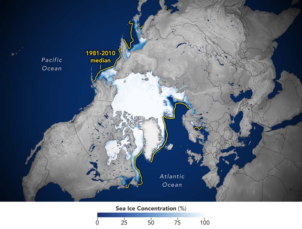
This image shows the average concentration of Arctic sea ice on Feb. 25, 2022. The yellow outline shows the median sea ice extent for the month of March, when the ice generally reaches its maximum extent, as observed by satellites from 1981 to 2010. A median is the middle value. That is, half of the extents were larger than the line, and half were smaller.
Credits: Joshua Stevens/NASA Earth Observatory
Sea ice waxes and wanes with the seasons every year. In the Arctic, it reaches its maximum extent around March after growing through the colder months, and shrinks to its minimum extent in September after melting through the warmer months. In the Southern Hemisphere, Antarctic sea ice follows an opposite cycle.
To estimate sea ice extent, satellite sensors gather sea ice data that are processed into daily images, each image grid cell spanning an area of roughly 25 kilometres by 25 kilometres. Scientists then use these images to estimate the extent of the ocean where sea ice covers at least 15% of the water.
Since satellites began reliably tracking sea ice in 1979, maximum extents in the Arctic have declined at a pace of about 13% per decade, with minimum extents declining at about 2,7% per decade. These trends are linked to warming caused by human activities such as emitting carbon dioxide, which traps heat in the atmosphere and causes temperatures to rise. NASA’s analysis also shows the Arctic is warming about three times faster than other regions.
This February, Antarctic sea ice dropped to a record-low minimum extent. But unlike in the Arctic, this sea ice has shown irregular ups and downs mainly because of the geographical features that surround it. Winds and ocean currents specifically linked to the Southern Ocean and Antarctica have a strong influence on sea ice extent.
Sea ice in the Arctic is surrounded by land, whereas sea ice in the Antarctic is surrounded only by ocean and can thus spread out more freely. Overall, the Antarctic sea ice record shows a slightly upward – but nearly flat – trend or increase.
Gains in Antarctic sea ice are not large enough to offset the losses of the Arctic. The ice in both regions helps regulate global temperatures. Even if Antarctic gains balanced sea ice levels globally, Arctic sea ice losses could still contribute to further regional and global warming.
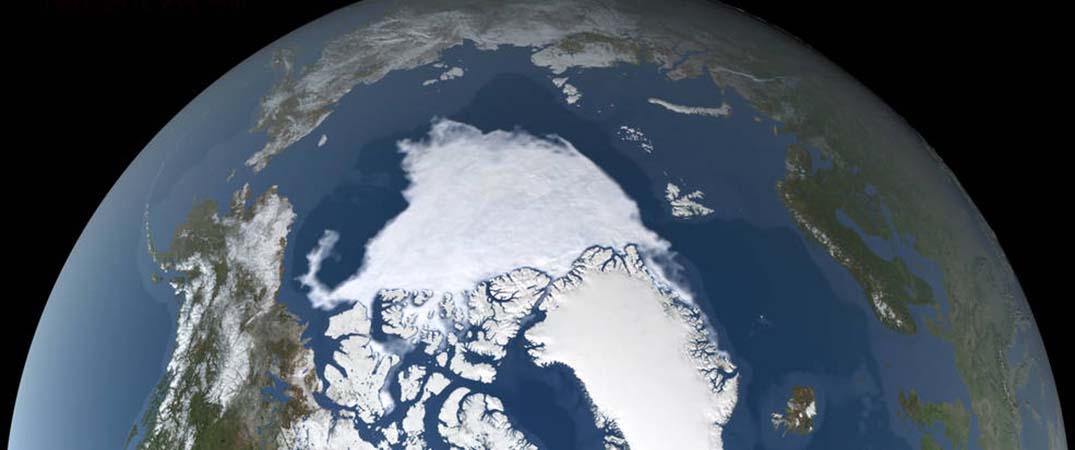
Banner image: This image visualizes wintertime sea ice change in the Arctic using data provided by the Japan Aerospace Exploration Agency’s Global Change Observation Mission 1st-Water “SHIZUKU” satellite, which is part of a NASA-led partnership to operate several Earth-observing satellites. The full video can be accessed at https://svs.gsfc.nasa.gov/4985.
Credit: NASA’s Scientific Visualization Studio