NOAA’s National Weather Service has announced that El Nino has developed in the tropical Pacific, and issued an El Nino Advisory.
El Nino, the warm phase of the El Nino Southern Oscillation (ENSO), is predicted to intensify to a moderate or strong level this fall.
Forecasters predict a 63% chance of sea surface temperatures exceeding 2°C in the Nino-monitored region of the Pacific.
If this threshold is surpassed, NOAA considers the event a “very strong” El Nino.
What is El Nino?
NOAA declares an El Nino (Spanish for “little boy”) has formed when temperatures in the equatorial Pacific are 0,5°C above average for several consecutive months.
Additionally, NOAA monitors the atmosphere above this region of the Pacific, looking for a pattern called the Walker Circulation, a massive east-to-west air flow driven by the temperature and pressure differences between the warm western and cool eastern oceans.
When the Walker Circulation breaks down and warmer water shifts east toward South America, El Nino is declared.
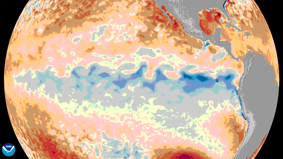
An animation of the change in sea surface temperature departures from average in the tropical Pacific Ocean, from January 1 through June 8, 2026.
Image credit: NOAA Satellites
“Every El Nino is not the same; each one is unique with its own imprint on our weather,” says Ken Graham, director of NOAA’s National Weather Service (NWS). “Advanced monitoring and an improved understanding of El Nino patterns allow the NWS to better predict and better prepare the public and our core partners for what is to come.”
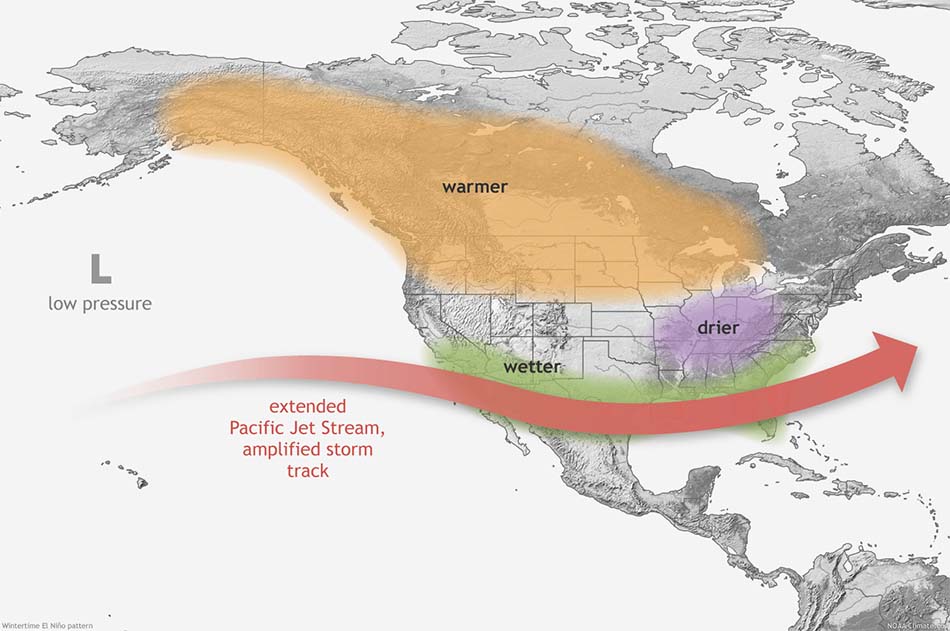
This map shows the typical impacts of El Nino to the continental U.S. and Canada during Northern Hemisphere winter.
Image credit: NOAA
A new way of monitoring ENSO
In February, NOAA officially adopted the Relative Oceanic Nino Index (RONI) for monitoring sea surface temperatures and forecasting El Nino and La Nina events.
Whereas the traditional Oceanic Nino Index (ONI) uses a static 30-year period of recorded ocean temperatures to calculate departures from average, RONI evolves from month to month, making this index more reliable for identifying El Nino and La Nina events.
NOAA’s ENSO team has been closely monitoring both the traditional ONI and RONI since 2021.
After observing several years of ENSO phases and the corresponding atmospheric response, NOAA scientists concluded that RONI more closely correlated with the expected changes in the Walker Circulation, and therefore provided more useful information about El Nino and La Nina events to weather experts, emergency managers and the public.
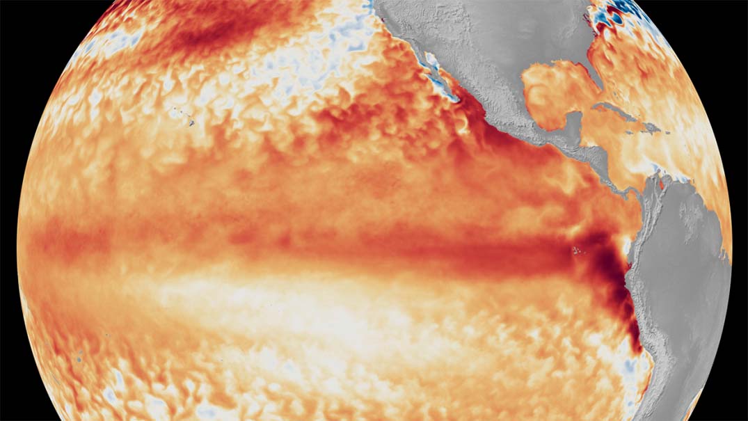
Featured picture: Satellite imagery showing the difference from average sea surface temperatures at the equator in the tropical Pacific Ocean (depicted using various shades of red and orange for warmth) during the first week of June 2026, as compared with the baseline used by NOAA’s Coral Reef Watch.
Image credit: NOAA Satellites